
L-BRASILEIRO (Levada do Brasileiro) is a 3.6 km, medium, community route. Whether it is worth hiking right now depends on live conditions and today's official status, re-checked every 20 minutes in the live app.
Madeira
A coastal forecast will not tell you what it is doing at 1041m up on this ridge. That is what the live score is for.
Go or wait today?
The difference between a clear morning above the clouds and a wet, foggy drive is knowing before you go. Levadas reads the live weather, the safe-start window and how busy Levada do Brasileiro is right now, then gives you one honest answer, re-checked every 20 minutes.
Ten seconds, one tap, from €2.99 once. No subscription.
Download GPX: free offline map
Grab the full GPS track and waypoints for Levada do Brasileiro as a free GPX file, no signup. Load it into Garmin, Komoot, AllTrails, Gaia GPS or OsmAnd and follow the route offline, even where there is no phone signal.
ⓘ Source & safety
Track and waypoints from OpenStreetMap contributors (ODbL). Planning aid, not a safety guarantee. Check the official trail status and conditions before you go.About Levada do Brasileiro
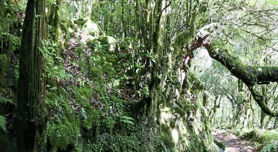
The Levada do Brasileiro is a short one-way levada walk near Porto Moniz that runs through dense laurisilva forest on the island's north-west corner. It follows the water channel on mostly irregular, sometimes steep ground, with green, sheltered scenery for most of the way.
Levada do Brasileiro (L-BRASILEIRO) is a one way route of about 3.6 km in Madeira.
What you'll see
The route takes in a levada water-channel path, laurel forest (laurisilva) and panoramic viewpoints.
Landmarks on the route include Casa do Elias - Porto Moniz and Fonte da Pedra.
The path runs between roughly 808 m and 1,041 m above sea level, so conditions can change with altitude.
Difficulty
Levada do Brasileiro is officially graded medium by IFCN, based on 3.6 km, 162 m of ascent and some exposed sections.
How long it takes
Allow about 2h one way, a point-to-point route.
The app's live 0-100 score also flags the latest safe start time for the day. See it in the app.
Getting there and back
Starts at Porto Moniz. This is a one-way route, so you finish where your car is not: plan a second car, a taxi from the far end, or the walk back before you set off. A car park is mapped for this route, though its size is not recorded. The car park is about 360 m from the start.
Frequently asked questions
Is Levada do Brasileiro worth hiking today?
It depends on today's conditions, and that is exactly what Levadas answers. The app reads the current weather at Levada do Brasileiro, the safe-start window, how busy it is and the official IFCN status, then gives one honest go-or-wait score from 0 to 100, re-checked every 20 minutes. It is decision-support, not a safety clearance: an official IFCN closure always overrides the score, no matter how good the weather looks.
How long is Levada do Brasileiro?
Levada do Brasileiro is about 3.6 km (one way).
How difficult is Levada do Brasileiro?
Levada do Brasileiro is officially graded medium by IFCN.
How long does Levada do Brasileiro take to walk?
Allow about 2h.
Can I download a GPX track for Levada do Brasileiro?
Yes. Tap Download GPX on this page: the first download on any device asks for an email so we can also send the free trail pack, then every later trail downloads instantly.
Is Levada do Brasileiro free to walk?
Yes. Levada do Brasileiro needs no reservation and has no fee. Only the regulated official PR trails require a paid SIMplifica booking; this one you simply walk.
Where does Levada do Brasileiro start and finish?
Levada do Brasileiro starts at Porto Moniz.
What will I see on Levada do Brasileiro?
Highlights include a levada water-channel path, laurel forest (laurisilva) and panoramic viewpoints.
How do I check live conditions for Levada do Brasileiro?
Levadas scores Levada do Brasileiro from 0 to 100 using live weather, official status and crowd signals, refreshed every 20 minutes. Open the trail in the app to see the live score and the best time to go today.