
Madeira · Live webcams
Madeira's live webcams, on the map that adds the forecast
Every Madeira regular knows the ritual: check the Pico do Arieiro cam the night before, guess, drive, hope. We put 27 live cams on the free trail map instead, each one sitting next to the live conditions and the 0 to 100 score for the trails around it, so the picture and the prediction check each other.
A webcam is an honest picture of one place. What it cannot do is stand in for a trail somewhere else. Cloud on Madeira forms against the terrain, so the same hour can be bright at the coast and inside the cloud a few kilometres inland and several hundred metres higher.
Open the live map with webcamsAll 27 cams, and the nearest marked trail to each
Straight-line distance from each camera to the nearest marked trail, and the height that trail starts at. Read the last two columns together: that gap is why the picture is not a forecast.
Streams by their public providers, credited on each cam. The map is free; no account needed.
What this camera can and cannot tell you
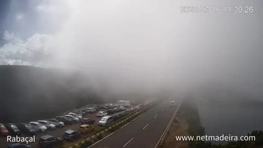
26 July 2026, 11:30. Rabaçal: full car park, grey wall. Our reading for that same minute: 55% cloud, 32 km visibility, 0 mm of rain, 18 degrees. The camera sits 37 m from the start of PR6 Levada das 25 Fontes. The waterfalls are 4.3 km further on, at the bottom of the valley.
Which is right? Neither, on its own. You cancelled a walk on 1 frame of a spot you were not going to.
We tested this instead of assuming it. Levadas ran a webcam calibration loop that compared a vision label of each camera's image against the weather sub-score we had computed for the trail nearest to it, and used the gap to nudge the scoring weights. We retired that loop on 20 July 2026 because the gap was never valid ground truth: a camera frames a patch of sky that does not represent the cloud sitting over the trail's own cell. That failed experiment is exactly why the live score reads the weather at the trail's own altitude every 20 minutes instead of reading a camera.
The evening cam check has a documented failure mode: Madeira's cloud rebuilds and dissolves overnight, so what the lens saw at 21:00 says little about 07:00. Our engine models the same sky the cams point at, from pressure levels, marine and microclimate data, and turns that into a per-trail score. Watch the cam for the mood; read the microclimate and the live score for the decision.
Common questions
Where can I watch the Pico do Arieiro webcam?
The summit cam is on our live map together with the other Madeira webcams, one tap from the trail scores. Checking it the evening before is the classic sunrise ritual, with a known flaw: a cloudy evening does not guarantee a cloudy dawn, which is why we pair every cam with the live forecast for its spot.
Are these webcams free to watch?
Yes. The streams come from their public providers, credited on each cam, and watching them on the map costs nothing.
Why look at a webcam and a forecast together?
A webcam shows now; it cannot show two hours ahead. A forecast shows ahead but can miss what is actually sitting on the mountain. That is why the two sit side by side on our map: look at both before you drive up, and once you are there, trust your eyes over any number, ours included.