
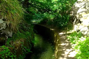
L-NORTE (Levada do Norte) is a 17.3 km, medium, community route. Whether it is worth hiking right now depends on live conditions and today's official status, re-checked every 20 minutes in the live app.
Madeira
A coastal forecast will not tell you what it is doing at 604m up here. That is what the live score is for.
Go or wait today?
At 604m, Levada do Norte makes its own weather. A coastal forecast will not tell you what today looks like up here. The pass reads the live conditions on the trail and gives you one honest answer, re-checked every 20 minutes.
Ten seconds, one tap, from €2.99 once. No subscription.
Download GPX: free offline map
Grab the full GPS track and waypoints for Levada do Norte as a free GPX file, no signup. Load it into Garmin, Komoot, AllTrails, Gaia GPS or OsmAnd and follow the route offline, even where there is no phone signal.
ⓘ Source & safety
Track and waypoints from OpenStreetMap contributors (ODbL). Planning aid, not a safety guarantee. Check the official trail status and conditions before you go.Getting there by bus
The nearest public bus stop to the Levada do Norte trailhead is Três Paus T-92 (709J), 2.3 km away. That is a straight line on the map and not a walk: on this terrain the climb between the two can matter more than the distance.
The timetable we hold ran until July 30, 2026 and no newer one has been published, so departure times are not shown. The stop and the lines serving it (092) are unchanged.
Horários do Funchal is the only Madeira operator that publishes a machine-readable timetable. A trail without this block is one we hold no bus data for, not one no bus reaches.
About Levada do Norte
The Levada do Norte follows the north-water channel from the regional-road crossing near Garachico down toward the town of Ribeira Brava, about 13 km in roughly four hours. It passes a 300 m tunnel by the Ribeiro da Caldeira and opens onto views over Câmara de Lobos, Funchal and Campanário before descending through Quinta Grande.
Levada do Norte (L-NORTE) is a one way route of about 17.3 km in Madeira.
What you'll see
The route takes in a levada water-channel path, walk-through tunnels, panoramic viewpoints and waterfalls.
The path runs between roughly 517 m and 604 m above sea level, so conditions can change with altitude.
Difficulty
Levada do Norte is officially graded medium by IFCN, based on 17.3 km and 441 m of ascent.
How long it takes
Allow about 4h one way, a point-to-point route.
The app's live 0-100 score also flags the latest safe start time for the day. See it in the app.
Getting there and back
Starts at Estrada regional crossing (Garachico / Quinta Grande). Ends at Vila da Ribeira Brava. This is a one-way route, so you finish where your car is not: plan a second car, a taxi from the far end, or the walk back before you set off. A car park is mapped for this route, though its size is not recorded. It is signed for customers of the business it belongs to, not public parking. The car park is about 520 m from the start.
What to bring
300 m tunnel by the Ribeiro da Caldeira.
Frequently asked questions
Is Levada do Norte worth hiking today?
It depends on today's conditions, and that is exactly what Levadas answers. The app reads the current weather at Levada do Norte, the safe-start window, how busy it is and the official IFCN status, then gives one honest go-or-wait score from 0 to 100, re-checked every 20 minutes. It is decision-support, not a safety clearance: an official IFCN closure always overrides the score, no matter how good the weather looks.
How long is Levada do Norte?
Levada do Norte is about 17.3 km (one way).
How difficult is Levada do Norte?
Levada do Norte is officially graded medium by IFCN.
How long does Levada do Norte take to walk?
Allow about 4h.
Can I download a GPX track for Levada do Norte?
Yes. Tap Download GPX on this page: the first download on any device asks for an email so we can also send the free trail pack, then every later trail downloads instantly.
Is Levada do Norte free to walk?
Yes. Levada do Norte needs no reservation and has no fee. Only the regulated official PR trails require a paid SIMplifica booking; this one you simply walk.
Where does Levada do Norte start and finish?
Levada do Norte starts at Estrada regional crossing (Garachico / Quinta Grande) and finishes at Vila da Ribeira Brava.
What will I see on Levada do Norte?
Highlights include a levada water-channel path, walk-through tunnels, panoramic viewpoints and waterfalls.
Are there tunnels on Levada do Norte? Do I need a torch?
300 m tunnel by the Ribeiro da Caldeira.
How do I check live conditions for Levada do Norte?
Levadas scores Levada do Norte from 0 to 100 using live weather, official status and crowd signals, refreshed every 20 minutes. Open the trail in the app to see the live score and the best time to go today.